Land surveying
The accuracy class you need. Not the price tag you were quoted.
Topo, boundary, control and stakeout — with the coordinate systems, datums and deliverable formats Indian work actually requires, and someone in your time zone when something goes wrong.
The problem
Your day today
The quote was fifteen lakh
Imported premium receivers price out exactly the surveyors who would use them every day.
A bad fix nobody caught
Float mistaken for fix, an antenna height typed wrong — and the re-survey costs more than the instrument saved.
Software that fights you
Wrong datum, wrong projection, an export format the department rejects. The instrument was never the hard part.
The workflow
How the job runs with Aerom
Set up
Base over a known point or on NTRIP corrections. Antenna height entered against a marked ARP datum, not guessed.
Collect
Point averaging, codes and attributes, photos against points. Fix state is shown in plain language, not a colour you have to remember.
Stake out
Navigate to design points with clear guidance in the field.
Export
Correct CRS and datum, in the format your deliverable actually needs.
Skip ahead — get the price sheet→ One email, same working day.
What you get
Built around this job, not a generic feature list
Indian CRS and datums
The projections and transformations Indian survey work runs on.
Honest fix reporting
FIX, FLOAT and SINGLE stated plainly, with correction age alongside.
Point averaging
Occupy and average, with the statistics recorded against the point.
Stakeout
Design points in, guidance out.
Audit metadata per point
Fix state, satellites, accuracy and antenna height stored with every observation.
Photos against points
Attach site photos to the point record for defensible evidence.
Specifications
The numbers that matter here
The full specification sheet goes out with the price sheet — these are the lines that decide this particular job.
- Receiver
- u-blox ZED-X20P, all-band multi-constellation
- Demonstrated RTK
- ~1 cm horizontal, ~1 cm vertical on our own hardware
- Corrections
- NTRIP client, own base, or RTCM3 in/out
- Pole
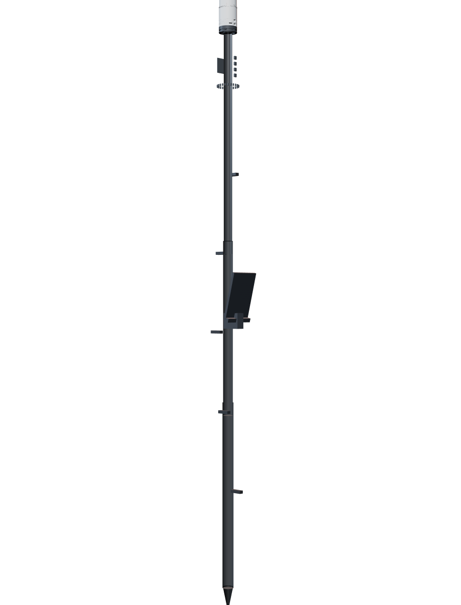
- Telescoping, ARP datum marker at a known height
- Coordinate systems
- Indian CRS, datums and export formats
- Tilt compensation
- Not yet — on the roadmap
Comparison
How Aerom stacks up for land surveying
Accuracy is broadly the same across this market. We have put the differences that actually decide a purchase side by side, including the one where we currently lose.
| Criterion | Trimble / LeicaPremium incumbent | CHC / Hi-TargetVolume leader | Emlid Reach RS4Disruptor | AeromUs |
|---|---|---|---|---|
| Horizontal RTK accuracy | ~8 mm + 1 ppm | ~8 mm + 1 ppm | ~7 mm + 1 ppm | ~1 cm demonstrated |
| Indicative India price | ₹15–25 L | ₹3–8 L | ~₹2 L | On request |
| Built in India | No | No | No | Yes |
| Support | Via dealer | Via dealer | Email, EU hours | Direct, in India |
| NavIC | Partial | Partial | No | On the roadmap |
| Indian survey workflows | Generic | Weak | Generic | Built for it |
| Tilt compensation | Yes | Yes | Yes | Roadmap |
| Software subscription | Paid, high | Bundled | ~₹21k / yr | Bundled + Pro tier |
Accuracy is table stakes. Published RTK accuracy across this market sits around 7–8 mm + 1 ppm horizontal, and we do not claim to beat it. We claim you should not have to pay ₹20 lakh for it. Note also the tilt-compensation row — that one is not in our favour yet, and we would rather you read it here than discover it later.
Indicative Indian street prices and published specifications, verified August 2026. Prices move; ask us for current figures.
Buying & support
What you actually get, and what happens afterwards
The questions that decide a purchase are rarely about accuracy. They are about delivery, warranty and who picks up the phone at 4pm on a Thursday.
In the box
- Aerom rover — receiver, gateway and antenna assembly
- Telescoping survey pole with marked ARP datum
- Swappable battery module
- Charger and cable set
- Flat phone cradle
- Transport case
- Calibration and antenna-offset record for your specific unit
- Lead time
- 4–6 weeks from order during the pilot programme
- Warranty
- 12 months against manufacturing defects
- Service turnaround
- Target 5 working days in-workshop, plus transit
- Support hours
- Monday to Saturday, 9am–7pm IST
- How you reach us
- Phone, WhatsApp and email — to us, not to a dealer
- Training
- Included: a live onboarding session for your crew, plus written and video guides in English and Hindi
Full warranty and service terms come with the quotation. Read them before you buy — from us or from anyone.
FAQ
Questions surveyors actually ask
Is this accurate enough for cadastral and boundary work?
Aerom has demonstrated ~1 cm horizontal and vertical RTK on its own hardware, which is the same accuracy class as receivers costing considerably more — published RTK accuracy across the market sits around 7–8 mm + 1 ppm. What matters as much for boundary work is the record: fix state, satellite count, accuracy and antenna height are stored against every point so the observation is defensible later.
Does it have tilt compensation?
Not yet. It is on the roadmap and we would rather say so than let you find out after purchase. Today you level the pole, as surveyors did for decades. If tilt is essential to your workflow right now, Aerom is not the right instrument for you yet.
What corrections can I use?
Your own base station, a commercial NTRIP service, or a CORS network where one covers your area. Owning the base means you are not dependent on coverage or a subscription.
Can I export to the formats my department requires?
Indian deliverable formats are a core part of what we build, and it is the main thing we ask pilot users about. If your department needs a format we do not yet write, tell us — that feedback is the point of the pilot programme.
What happens if it breaks on site?
You call or WhatsApp us directly — there is no dealer in between, which is the point. Support runs Monday to Saturday, 9am to 7pm IST. If the unit has to come in, we target five working days in the workshop plus transit. During the pilot programme we will also talk to you about a loan unit so a fault does not stop your job; ask us and we will tell you honestly what we can cover at your location.
What warranty do you offer?
Twelve months against manufacturing defects from the date of delivery, covering the receiver, gateway, antenna and battery module. Physical damage, water ingress beyond the rated conditions and unauthorised opening are not covered. Full terms come with the quotation — read them before you buy, from us or from anyone.
How long from order to delivery?
Four to six weeks during the pilot programme. We would rather quote a real date and hit it than quote two weeks and disappoint you. If you have a project deadline, tell us the date when you enquire and we will tell you straight away whether we can meet it.
Who trains my crew?
We do, directly. A live onboarding session for your team is included, plus written and video guides in English and Hindi. For institutional deployments we run a longer session and help you set standard project templates so every crew works to the same configuration.
What if I already use another brand's workflow?
Aerom exports the standard formats — RINEX, CSV, and the CAD and government deliverable formats — so it drops into an existing office workflow rather than replacing it. If your deliverable needs a format we do not yet write, tell us during the pilot; that feedback is exactly what the programme is for.
Can I see one before I commit?
Yes, and you should. We would rather you handled a unit and ran it against a control point you already know the answer to than took our word for anything on this website.
Next step
Talk to us about land surveying
Aerom is in its pilot programme. Tell us about your work and we will arrange a demo, answer specification questions, and send the price sheet.
Prefer email? prashantkr2804@gmail.com